
Size: Approximately 0.34 acres
Notes from the City:
- The land is currently zoned “Residential Type 2 – R2”.
This website uses cookies to enhance usability and provide you with a more personal experience. By using this website, you agree to our use of cookies as explained in our Privacy Policy.
The City of Pembroke has 10 properties declared surplus and available to be sold for development.
To discuss these opportunities and the process to purchase these lands, please contact the Investment Attraction Officer directly.
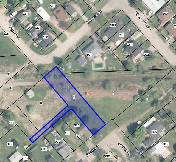
Almira Street Unopened Road Allowance
Size: Approximately 0.34 acres
Notes from the City:
Dominion Street (end of street off McGee Street)

Size: Approximately 0.78 acres
Notes from the City:
Doran Street (near D'Arcy Street)

Size: Approximately 0.44 acres
Notes from the City:
Property from time to time subject to flooding from the Indian River.
Draper Street (off McGee Street)

Size: Approximately 0.42 acres
Notes from the City:
James Street (end of street off McGee Street)

Size: Approximately 1.2 acres
Notes from the City:
Horace Street (near Bishop Smith Catholic High School)
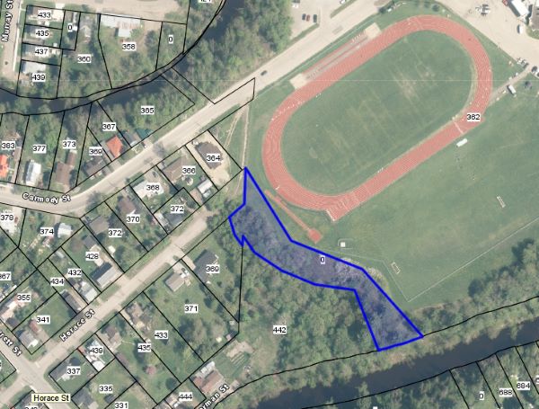
Size: Approximately 0.85 acres
Legal description:Part Lot 200, Plan 103; Part Lot 15, Concession 1, Pembroke, as in PMC19985, BTN R329706 and PMC30163, the Indian River and Horace Street, Plan 103; City of Pembroke and being all of PIN #57164-0298 (LT)
Notes from the City:
Julien Street Unopened Road Allowance
Size: Approximately 0.23 acres
Notes from the City:
Metcalfe Street (across from Operations Department)

Size: Approximately 0.14 acres
Notes from the City:
Thompson Street (off Eganville Road)

Size: Left parcel: Approximately 2.6 acres. Right parcel: Approximately 0.95 acres.
Notes from the City:
Contact Us
Investment Attraction Officer
1 Pembroke St. E.
Pembroke, ON
K8A 3J5
Phone: 613-735-6821 ext. 1520
Email